****↓
Oregon Territory, 1841 JPG file 14 MB
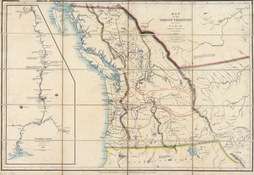
Oregon Territory as mapped by Lt. Charles Wilkes, commander of U.S. Exploring Expedition, 1841.
Among his crew’s many explorations to help document the American claim to the Paci c Northwest, Wilkes had traveled up the Columbia River and from there led an overland journey into the Willamette Valley. Here the existence of the Long Tom River is noted but it is not yet named.
****↓
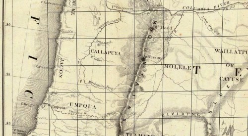
Map of Oregon and Upper California from Surveys of John Charles Fremont. Drawn by Charles Preuss Under the Order of the Senate of United States, Washington City, 1848.
The Preuss map is thought to have been based on the earlier Wilkes map rather than physical surveys taken of the area. The unnamed Long Tom appears the same, but spelling of Willamette River is its more original spelling.
****↓
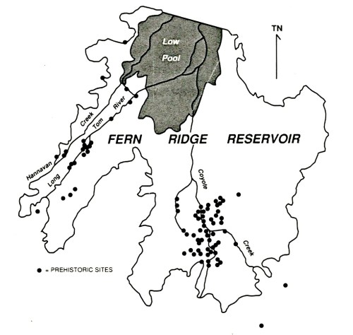
Prehistoric Settlement sites in Fern Ridge Reservoir area. Map by Richard D. Cheatham.
****↓
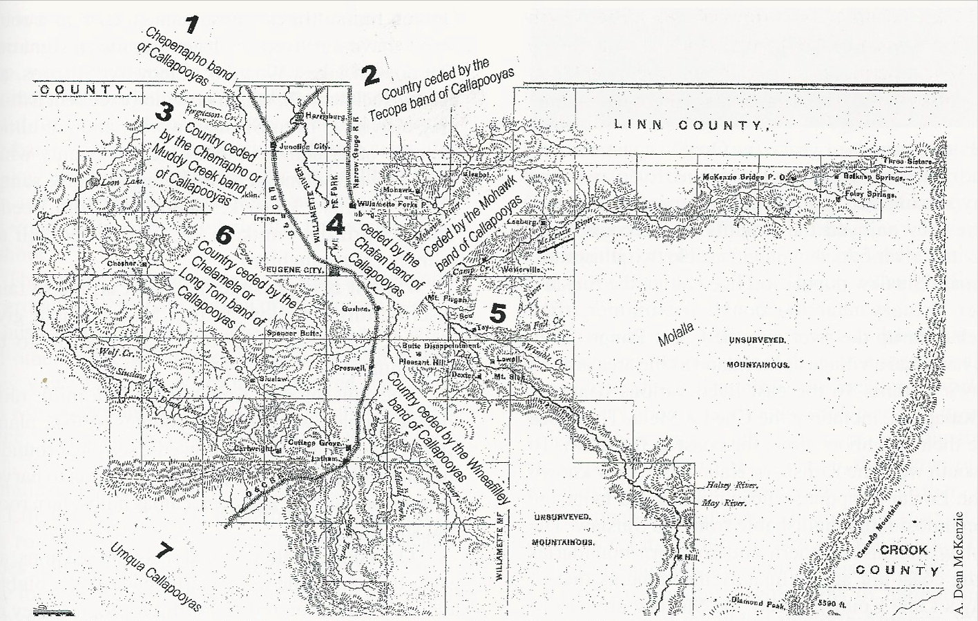
Kalapuya Ceded Lands JPG file 1.5 MB
The Kalapuya bands living in or near the vicinity of Lane county. The general locations are based on original Joel Palmer treaty map, which was clari ed by Henry Zenk and Josh Levy for the Confederated Tribes of Grand Ronde in Mackey’s book on Kalapuya.
****↓

Inman Old Trail Map
from Lane County Historian, Lane County Pioneer-Historical Society, Vol. XII-Nos. 1,2; Eugene, Oregon; Spring and Summer, 1967.
This hand-drawn map is one of the best descriptions of where early settlements were along the Long Tom River.
Inman Old Trail Map.tiff 11.5 MB
****↓
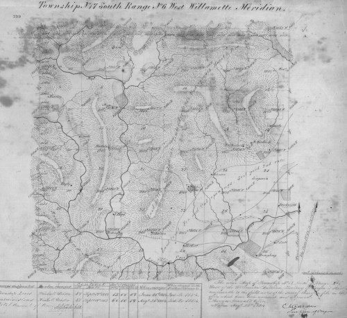
General Land Office Map, Township 17s, Range 6w, 1854
GLO Map, 17s,6w JPG file 7 MB
These very detailed maps, created in the early 1850s, resulted from a massive survey project to document the features and exact locations of the land that was to be given to homesteaders through the Donation Land Act in the Oregon Territory. They show “West Fork Long Tom Creek” coming from Duckworth’s to the west and meeting the “East Fork” of the Long Tom, today’s Coyote Creek. Following the Old Trail from the south, we rst see the Donation Land Claim of Levi and Mary Zumwalt, which is today’s Zumwalt Park, and the nearby campground. And north of this area, along the slough, is the claim of Ben Richardson and family.
****↓
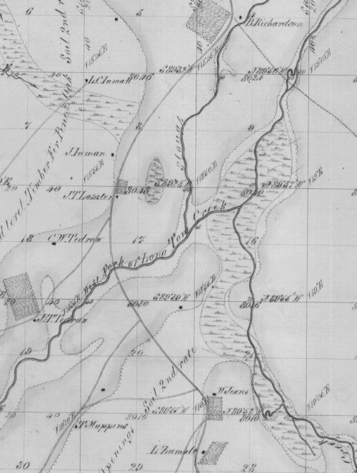
Township 17s, Range 5w (detail), 1854
GLO 17s,5w JPG file 2 MB
This map shows the Long Tom “Creek” coming in from the west and the north, near its headwaters. The lower right corner (Section 36) has the Donation Land Claim of A.L. Humphrey (#44 on Inman map) on the Long Tom, approximate site
of Oregon Country Fair today. Just up the road is I.N. Duckworth, rst settler at the site of today’s Elmira. They are not on the Old Trail, but near where Territorial was later developed.
