Chapter by Ed Alverson
Ed Alverson, Eugene, has 35 years experience as a field botanist in the Pacific Northwest and has particular interest in prairie and oak habitat conservation, and historical ecology of the Willamette Valley. Ed has served on the Charter Committee, Steering Committee, and Technical Team for the Long Tom Watershed Council.
General Descriptions Of Townships From G.L.O. Surveys
Long Tom Watershed Townships South, Ranges West, Willamette Meridian
Early government land surveys from the 1800’s followed a set protocol to divide the landscape in to a grid of townships, six miles on a side, and sections, one mile on a side. In the Willamette Valley these surveys were done in the 1850’s, soon after the arrival of the rst wave of American settlers. Surveyors worked southward from a starting point, the “Willamette Stone,” in the hills west of Portland. The maps, survey notes, and descriptions contained within the land survey records provide a comprehensive survey of the vegetation and landscape, and documents the locations of prairies and woodland, rivers and wetlands, hills and valleys, homesteads and trails.
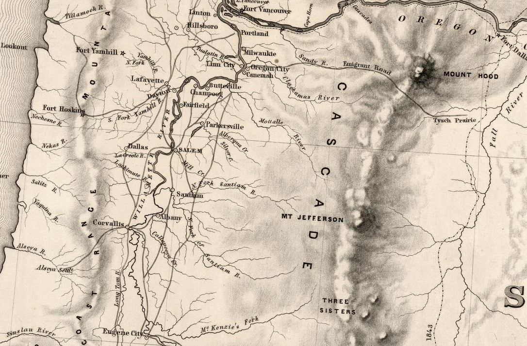
Map of Oregon Territory, 1859. Compiled from surveys and explorations of Capt. J.C. Fremont and eleven other survey teams from 1846 through 1857. Engraved by WQ.H. Dougal
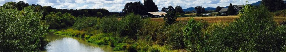
Below are a selection of General Land Office (GLO) township maps from the 1850s of the Long Tom Watershed, along with narrative descriptions provided by each surveyor for the township at hand. For comparison, current aerial photos showing the same township footprint are also presented. In these documents a bit of the wild character of each township shows through – some of which can still be recognized in specific features of the landscape today. While the past is forever behind us, we can take these historic records as a source of inspiration as we work to create a future landscape that provides for the needs of both its human communities and its natural communities.
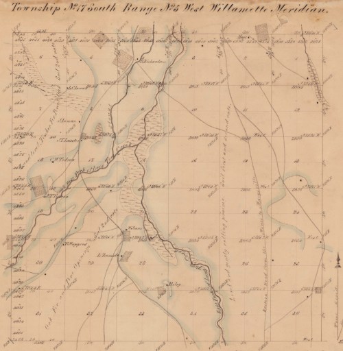
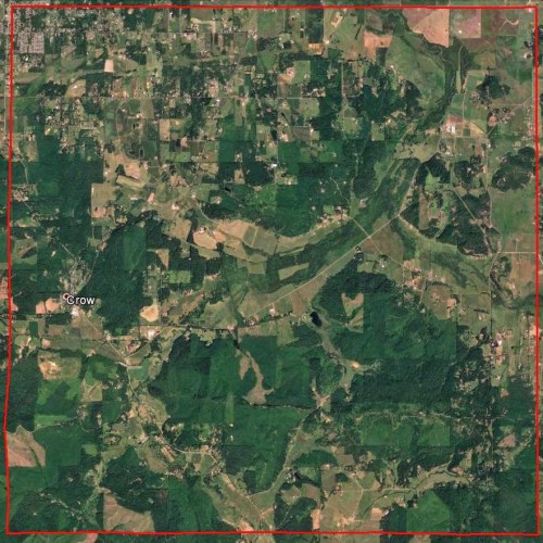
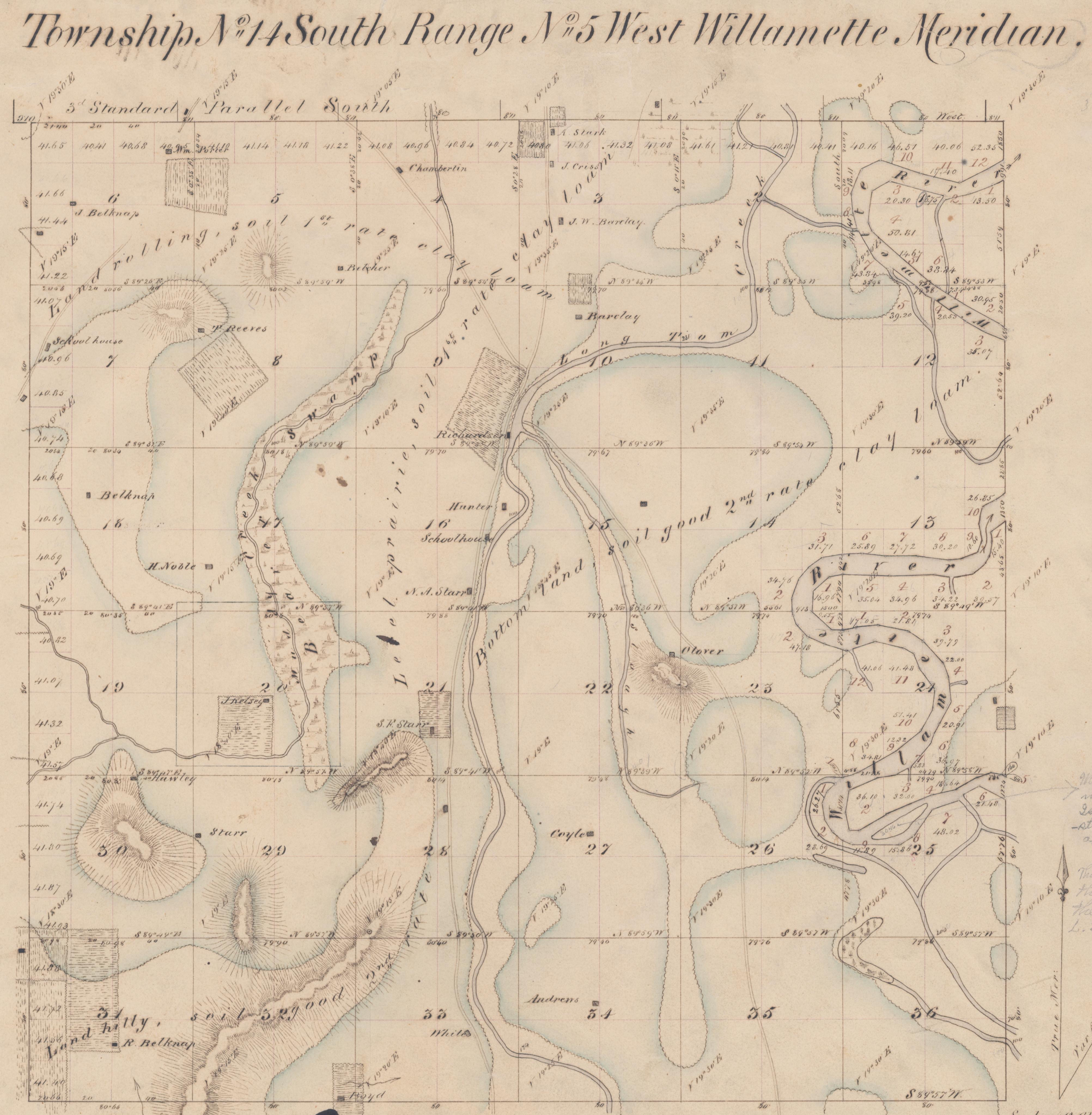
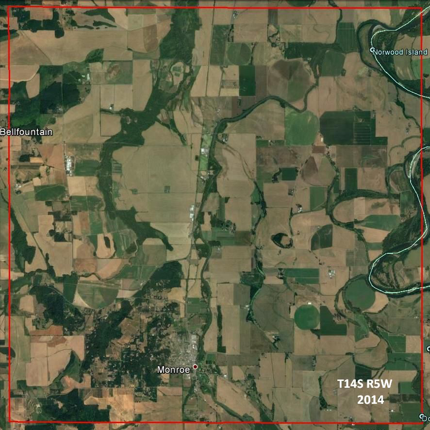
T14S,R5W, 1853
The portion of this township lying west of the Willamette bottom in principally rolling prairie and has as rich a soil as any part of the Willamette Valley. The land lying be- tween the Willamette River & Long Tom Creek may all be called bottom lands and is nearly all subject to inundation at the highest stages of water. A portion of it has a rich clay loam soil and a portion has a grav- elly soil. The bottom along the river is well timbered with fir, maple, ash, balm (cottonwood), and alder, with a dense undergrowth of hazel, vine maple, briars, thorns, and vines. The timbered bottom in sandy and has been inundated the present winter to the depth of 12 or 15 feet. There are some hills near the western side of the township timbered with oak with a red soil which produces a ne quality of grass. This township contains about 30 settlers, the most of which are west of the Long Tom.


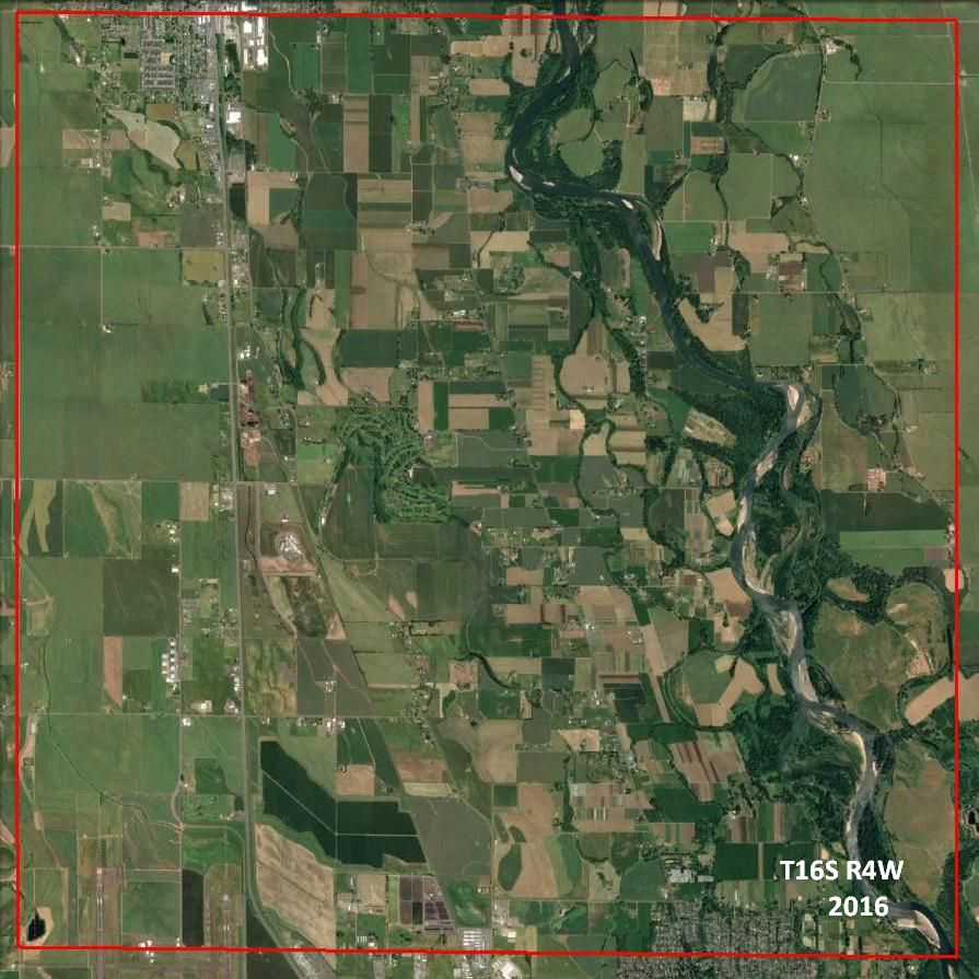
T14s,R5w Google map PNG file 1 MB T16S, R4W
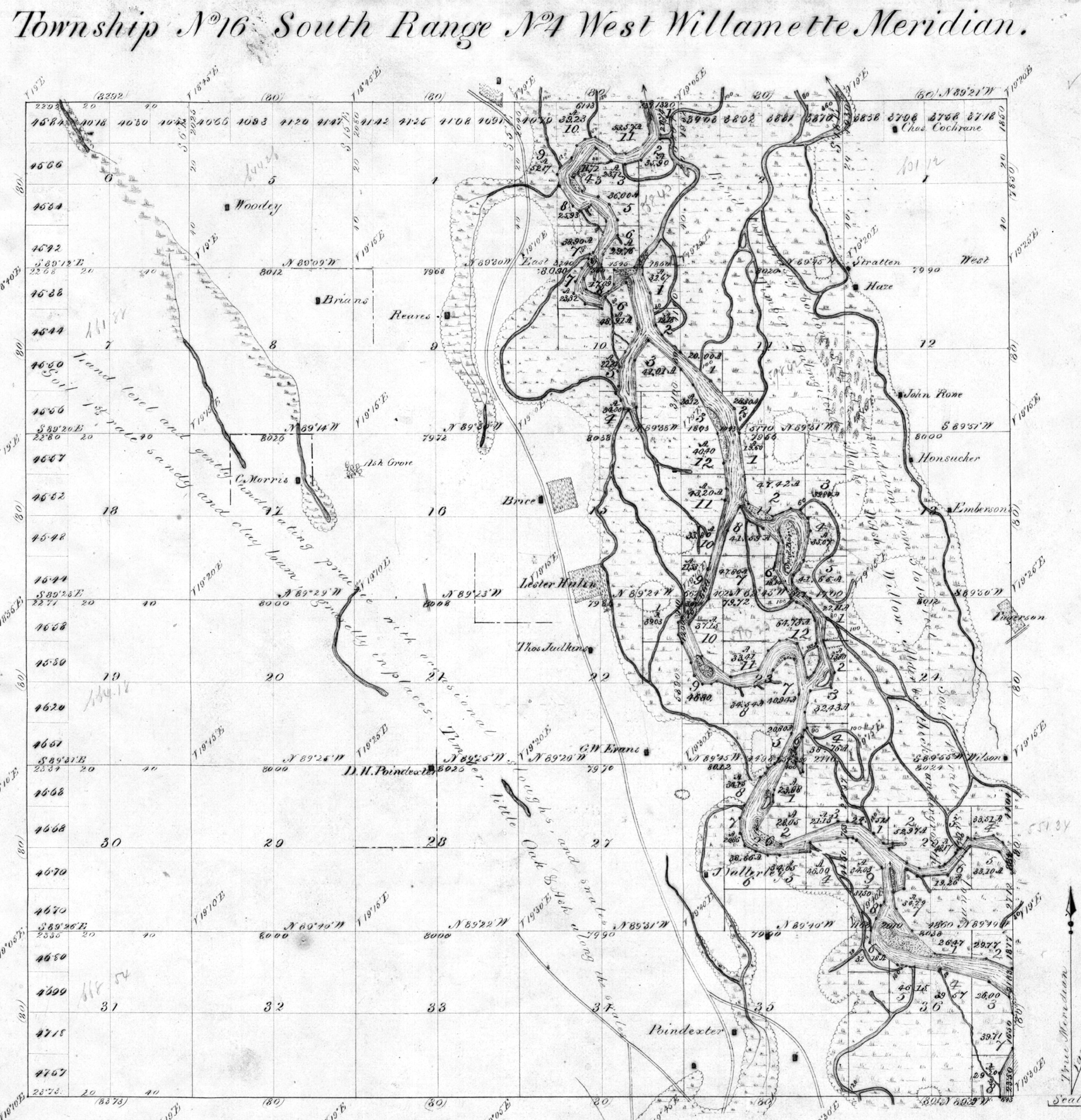
Butler Ives, January 26-February 9, 1853
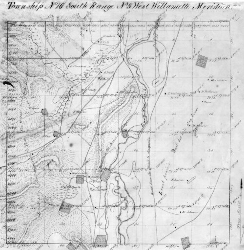
The surface of this township is low and level. All part of the bottom land along the river is a low nearly level prairie, interspersed with occasional swales and sloughs which contain running water in the wet season….The Willamette River through this township has generally a rapid current, with many shoal places obstructed with drift snags etc., long portions of the river branch o in to small channels which renders it entirely unfit for navigation. The banks are low from 5 to 8 feet high, and are being washed away and shifted more or less, by every rise of the river. The timber is princi- pally balm gilead, maple, white ash, willow, alder, and a little fir, white oak, and yellow pine, all of which is found in the bottoms and along the margin of the prairies and swales. The soil is generally 1st rate sandy and clay loam and in many places gravelly, all good producing (?) land. Only about half the township is yet settled.

GLO T16s.R4w JPG file 2.8 MB
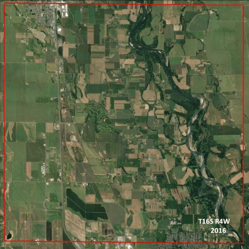
T16s.R4w Google map, 2016 PNG file 1 MB
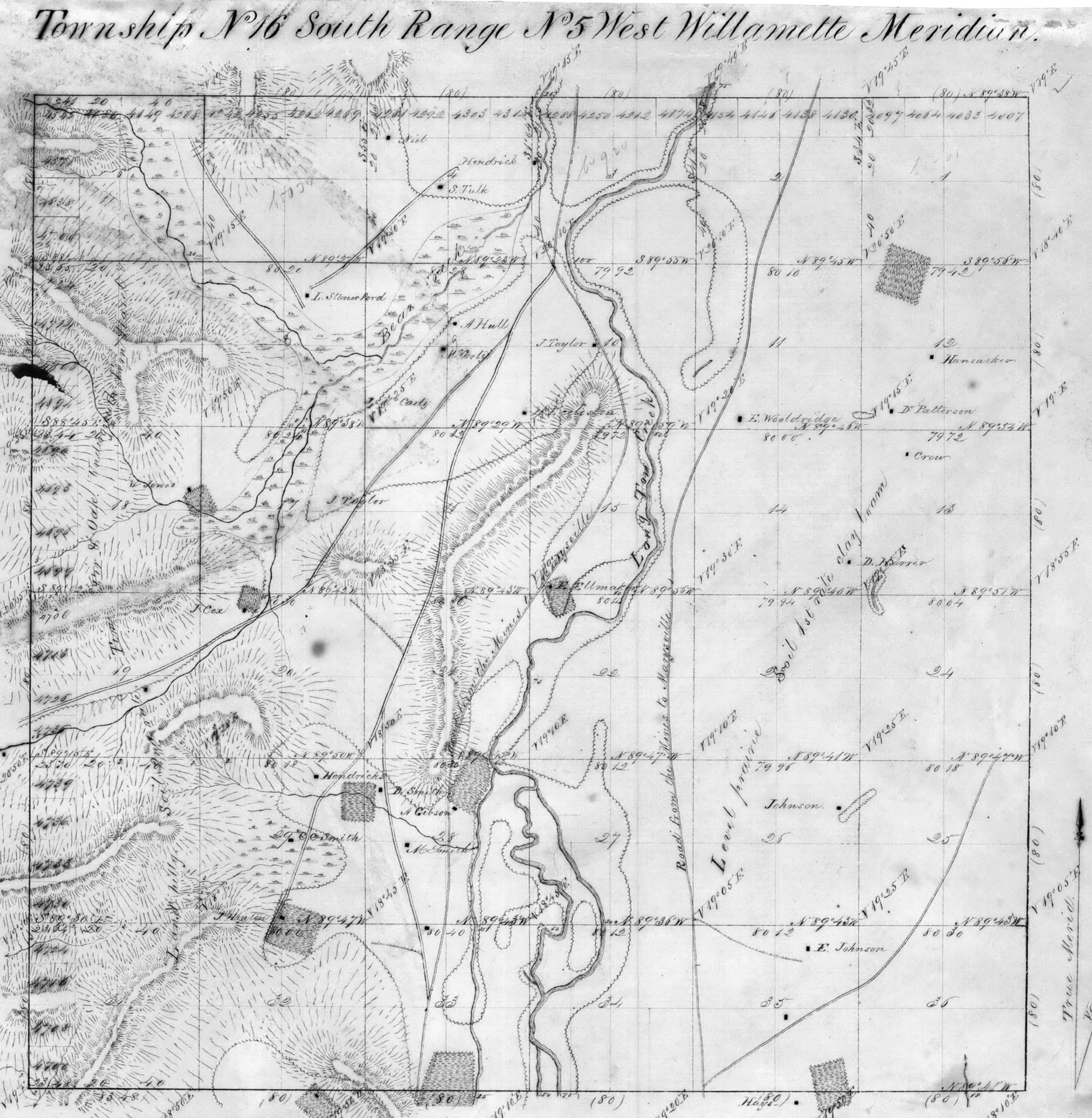
T16S, R5W, 1853
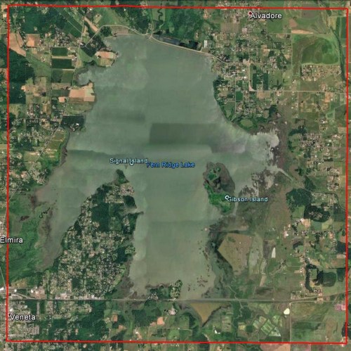
The east part of this township is principally level prairie and has a rich productive soil of clay loam and is chiefly settled but as the settlements are new the improvements are very small. The Long Tom Creek is a sluggish stream from 50 to 100 links in width and runs through the township near the center from south to north. On both sides of this stream are low bottoms covered with water in the rainy season from 12 to 18 inches in depth. These bottoms have a rich soil and in many places are covered with scrubby ash and oak timber with a dense undergrowth of hazel, ninebark, rose bushes, and briars of various kinds. The west side of the township is generally hilly and rolling, soils 2nd and good 2nd rate. Timber oak, fir and pine, and the greater portion of it is settled and there are still some very good locations unoccupied. There are two roads through this township leading from Marysville (Corvallis) to the Umpqua Valley and the mines, one on the east side of Long Tom and one on the west. This township contains about 35 settlers and will probably become one of the best agricultural townships of the Willamette Valley.
 GLO T16S, R5W, 1853 JPG file 2 MB
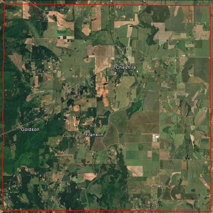
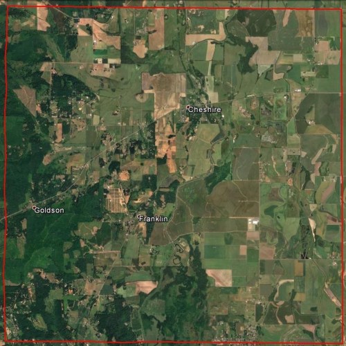 Google Earth, T16S, R5W, 2016 PNG 1.3 MB
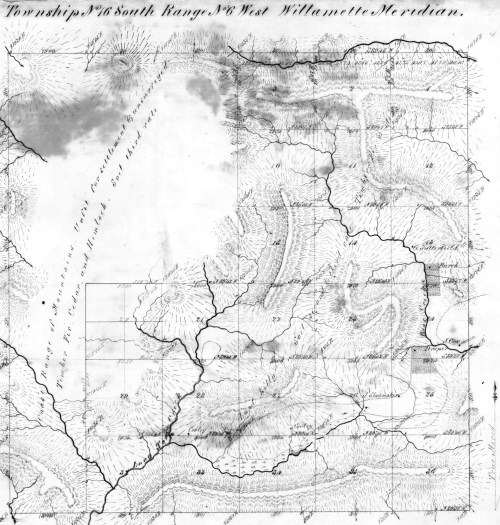
T16S, R6W, 1854
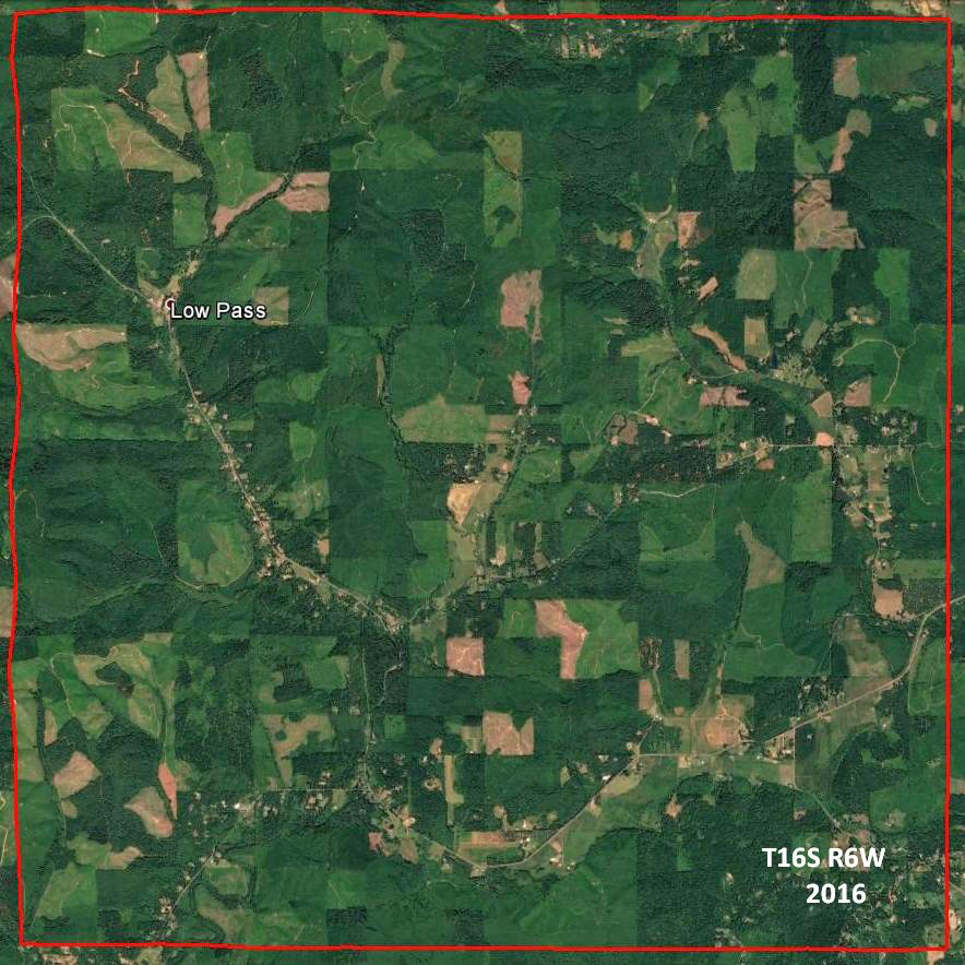
The quality of the land in this township is below the common average. The greater portion of the township is hilly, has a red gravelly soil, and is thinly timbered with oak and fir. There are several small vallies which have a good soil and are principally settled and yet there are some that are still vacant. The hills produce some grass and are well supplied with pure cool water by the numerous small streams which are found in nearly every ravine. The unsurveyed part of the township consists of rough hills and mountains and is unfit for settlement. The mountains are timbered with fir, undergrowth hazel, laurel, etc. There are but 8 settlers in the township.
 GLO T16S, R6W, 1854 JPG file 2 MB
 Google Earth T16S, R6W, 2016 PNG file 1.3 MB
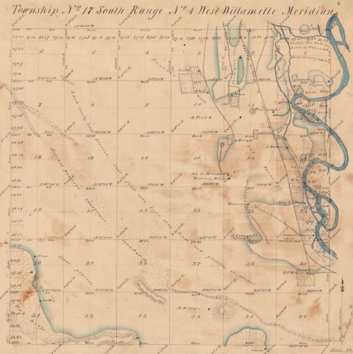
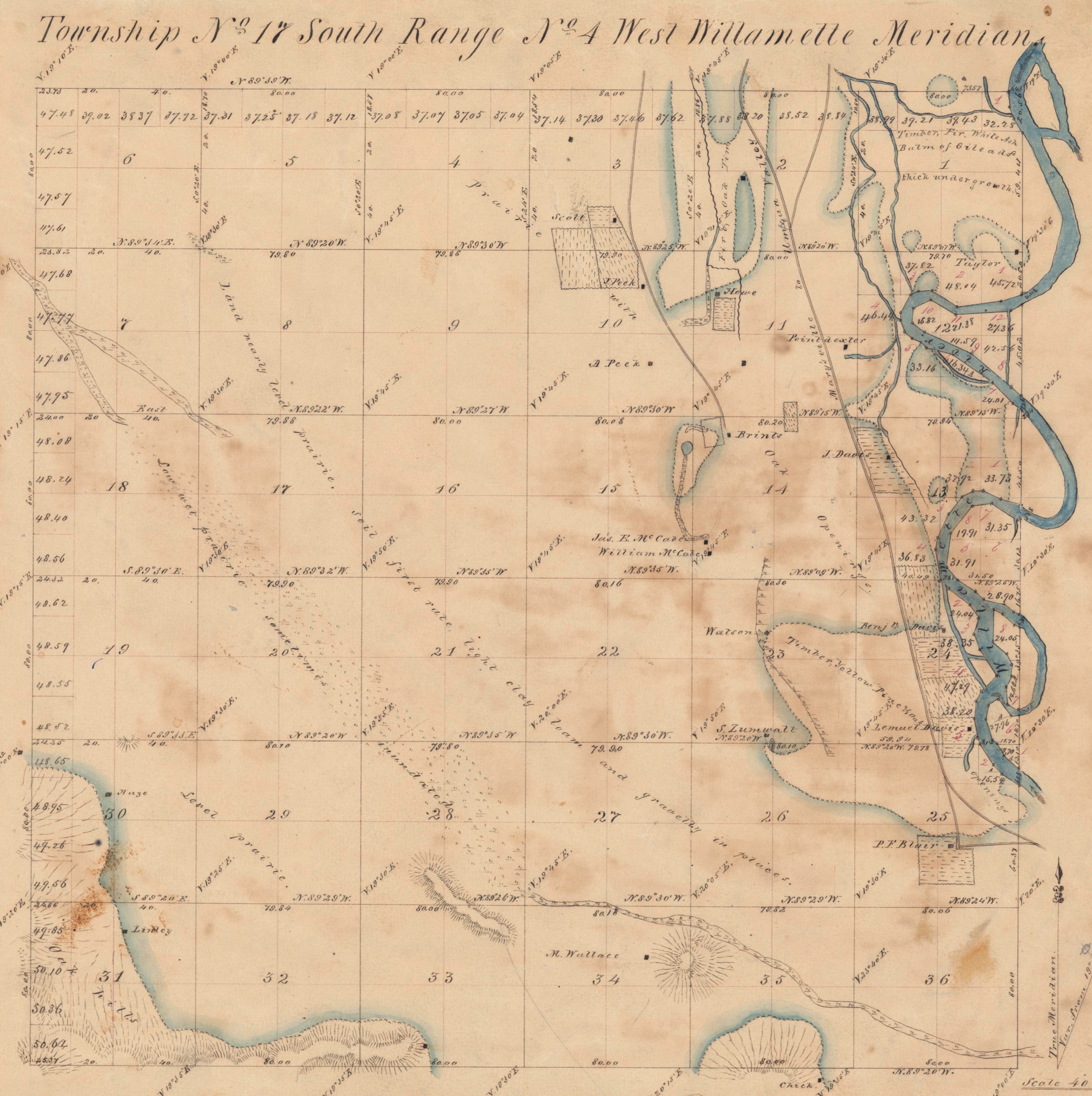
T17S, R4W, 1853
The surface of this township is very uniform and is elevated but 8 to 15 feet above the level of the Willamette River, except a few oak hills in the SW corner. Consequently about a third of the NE part and a portion in the SW is subject to inundation from 1 to 3 feet deep, at very high water of the Willamette River. Nearly three fourths of the township, the south and westerly portion, is level and gently undulating prairie with a few low places which are filled with water in the wet season, forming small ponds sloughs. Cammas root is found in plenty in some parts of the prairie. The timber along the river is predominantly ash, balm of gilead, alder, willow, fir, etc., with white and black oak and pine openings along the margin of the prairie. The soil is first rate, of a light clay loam and gravelly in places, some sandy along the river, all good farming land. About one half of the township is settled, the middle and NW portion is yet vacant.
 GLO T17S, R4W, 1854 JPG file 2 MB
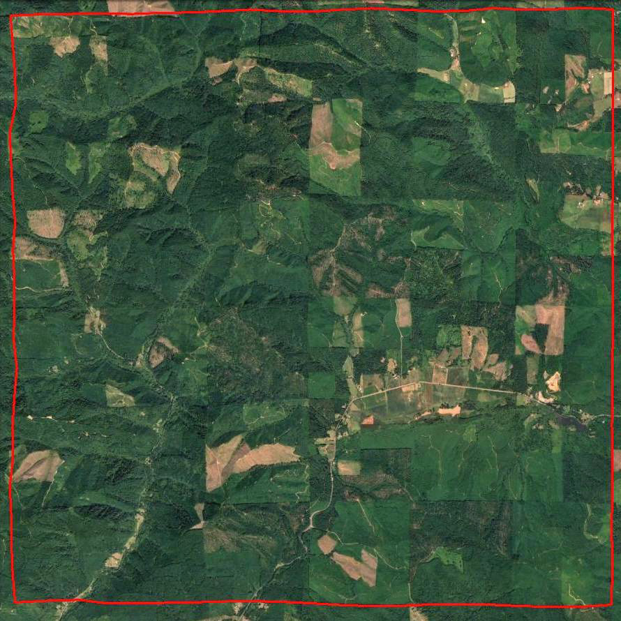
Google Earth T17S, R4W, 2016 PNG file 1 MB
T17S, R5W, 1853
The portion of this township east of the Long Tom Creek is level and gently rolling prairie with some scattering oak timber near the eastern boundary. The soil is 1st and good 2nd rate and is fast being settled. West of the creek is part prairie and part timbered with oak, fir, and pine, soil 1st and 2nd rate. Along the creek the land is low and swampy covered with water in the rainy season from 3 to 3 feet deep. The most of these swamps are covered with a dense growth of willows with some ash, and are caused by numerous beaver dams across the creek. This township contains about (blank) settlers, many of which have settled within a few months, and the improvements are small. The township is intersected by a road leading from Marysville (Corvallis) to the mines.
GLO T17S, R5W, 1853 JPG file 5 MB
Google Earth T17S, R5W, 2016 PNG file 1 MB
T17S, R7W, 1860
The soil on the east side of this township is good, consisting of black loam with good bottom. On the west side it is a light red clay of 2nd & 3rd rate quality. The growth of timber is large, heavy, and of an excellent quality, consisting principally of fir, hemlock, maple & alder. There is an unusual amount of hemlock which grows very large. The country is principally rolling, level enough for cultivation and presents sufficient inducements for an early settlement.

GLO T17S, R7W, 1860 JPG file 2 MB
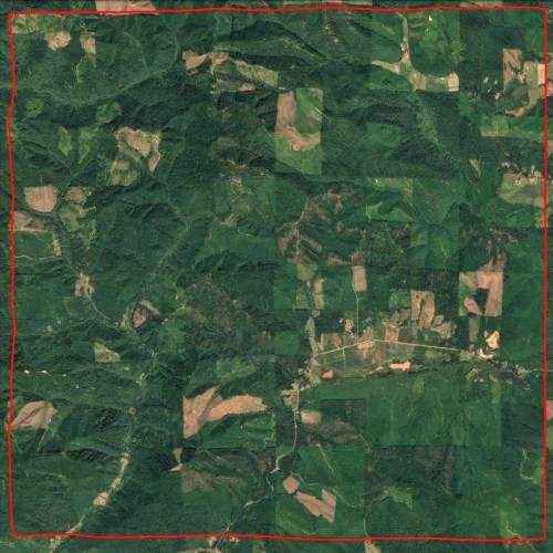
Google Earth T17S, R7W, 2016 PNG file 1 MB
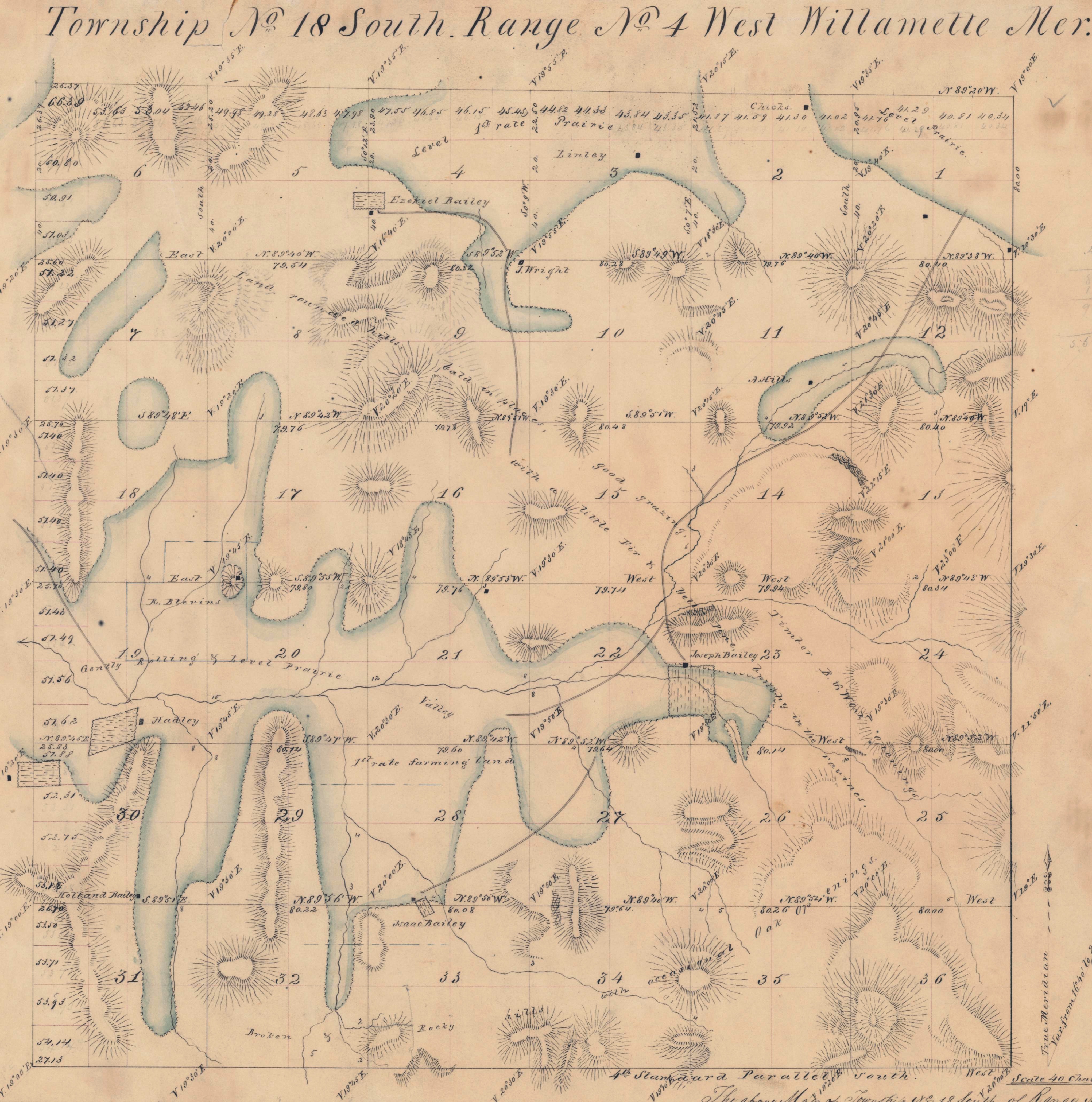
T18S, R4W, 1853
This township has a very unequal surface being mostly rounded irregular hills some broken in the south and SE parts. Some 1st rate level and gently rolling prairie land, well adapted to agricultural purposes, is found along the north boundary and in a valley in the middle and western portion of the township. Good grazing for stock is found in the hills except in the summer months when they become parched and dry. The streams usually dry up in the summer, but a sufficient number of good springs are found to supply stock, etc. with water. The timber is principally low bushy (?) black and white oak openings some scattering yellow pine and considerable fir in the south part of the township; usually thick brush in the ravines and on steep declivities. Basaltic rocks are exposed at the surface in most of the hills. A yellowish coarse grained sandstone was noted in several places, which is suitable for building purposes. About one third of the township is claimed mostly by new settlers, but few improvements have yet been made. There are a few good claims yet vacant.
 GLO T18S, R4W, 1853 JPG file 2 MB
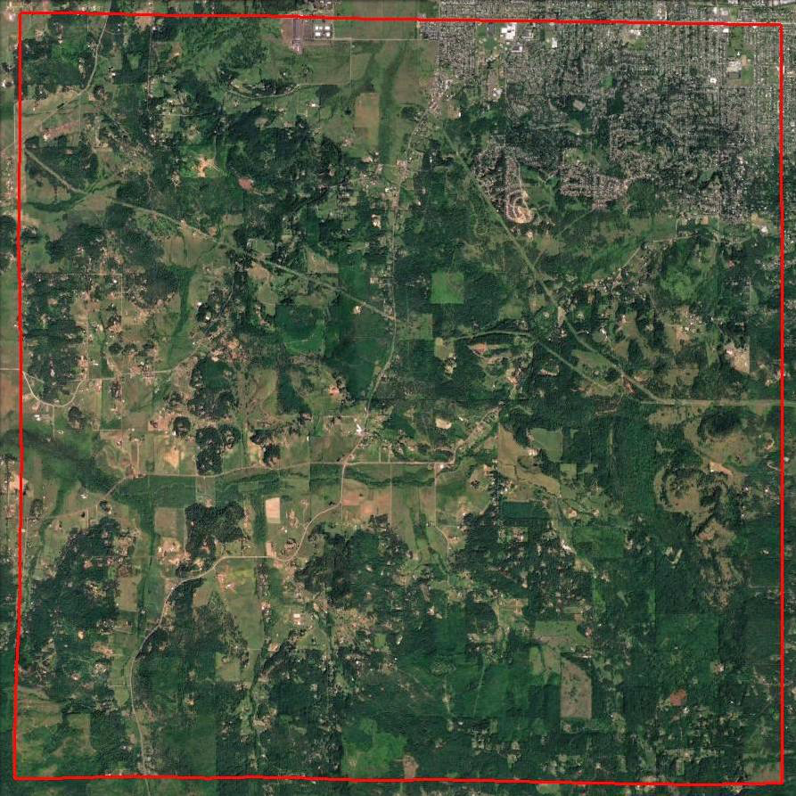
Google Earth T18S, R4W, 2016 PNG file 1 MB
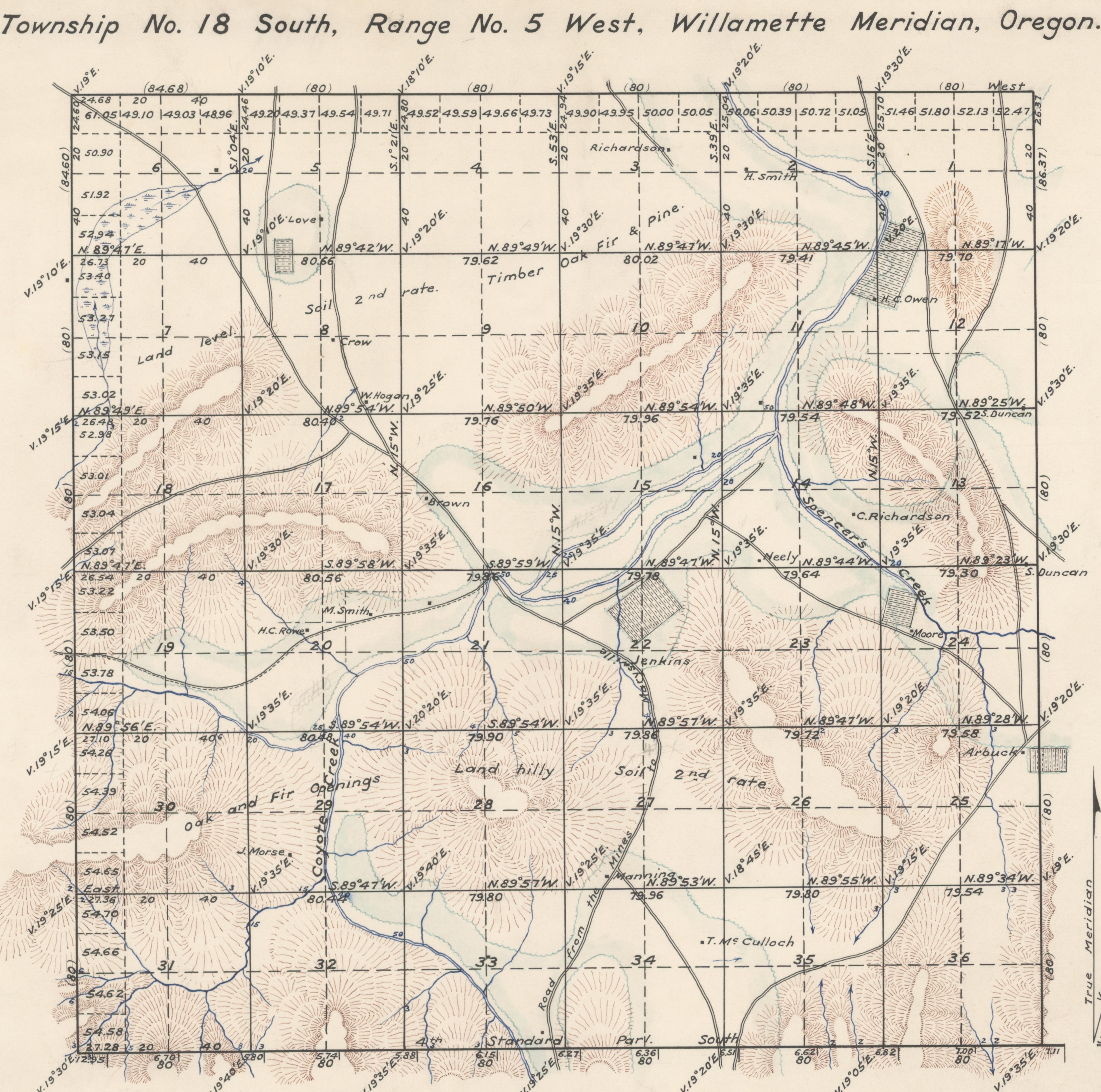
T18S, R5W, 1853
This township is somewhat hilly and broken. The hills are timbered with fir & oak and are generally brushy on the north sides while the south sides are covered with a fine quality of grass. The soil is second rate. The hills are supplied with plenty of cool pure water by numerous small streams many of which sink on reaching the valley. There are numerous small valleys among the hills which have a rich soil of clay loam and are very productive affording many good locations for first rate farms. There are now in this township about 25 settlers many of whom have settled within the last few months. Coyote Creek is a stream from 30 to 50 links in width running through the township from south to north and has a valley from 1/2 to 2 mile in width. The soil of which is 1st rate but in many places is very wet in the rainy season. The creek is skirted with oak and ash timber with a dense undergrowth of ninebark, ash, briars, etc. The road leading from Marysville to the Umpqua Valley and the mines runs through this township affording a good outlet for the mines and also to the lower part of the valley.

GLO T18S, R5W, 1853 JPG file 2 MB
Google Earth T18S, R5W, 2016 PGN file 1 MB
